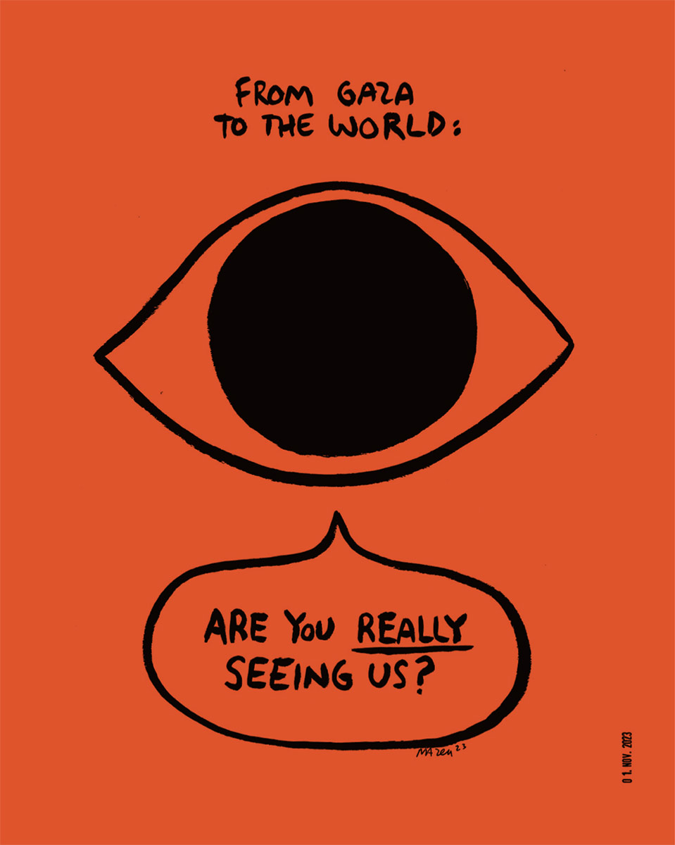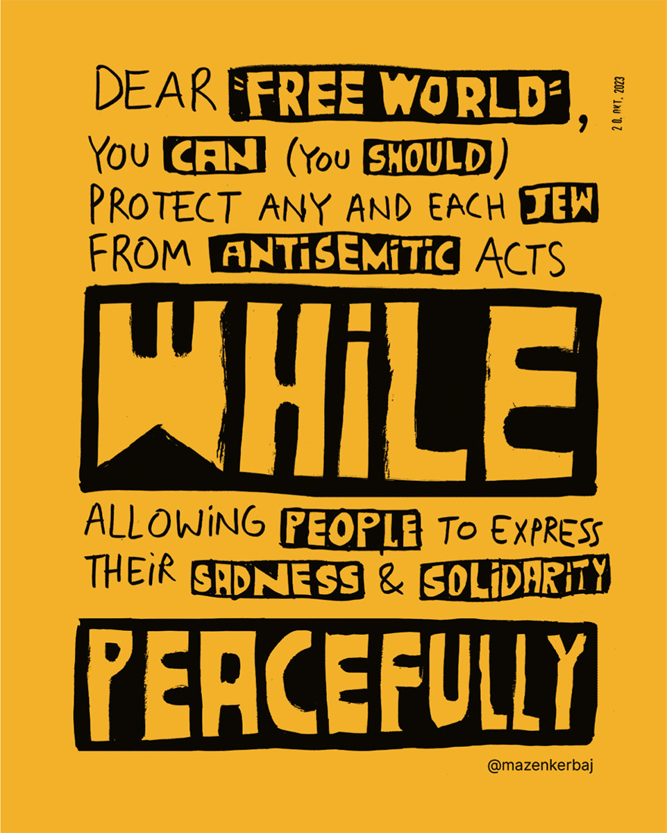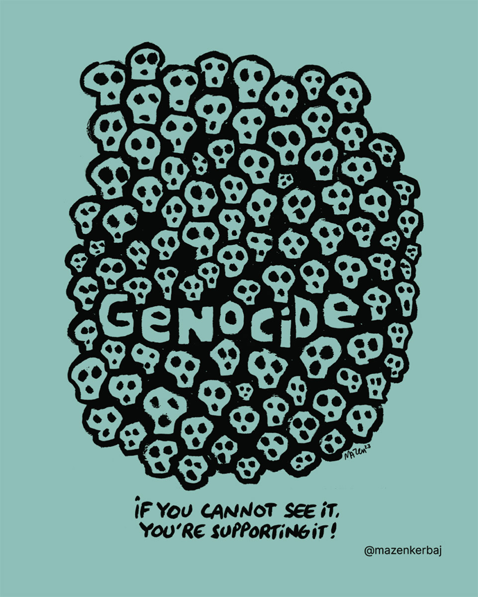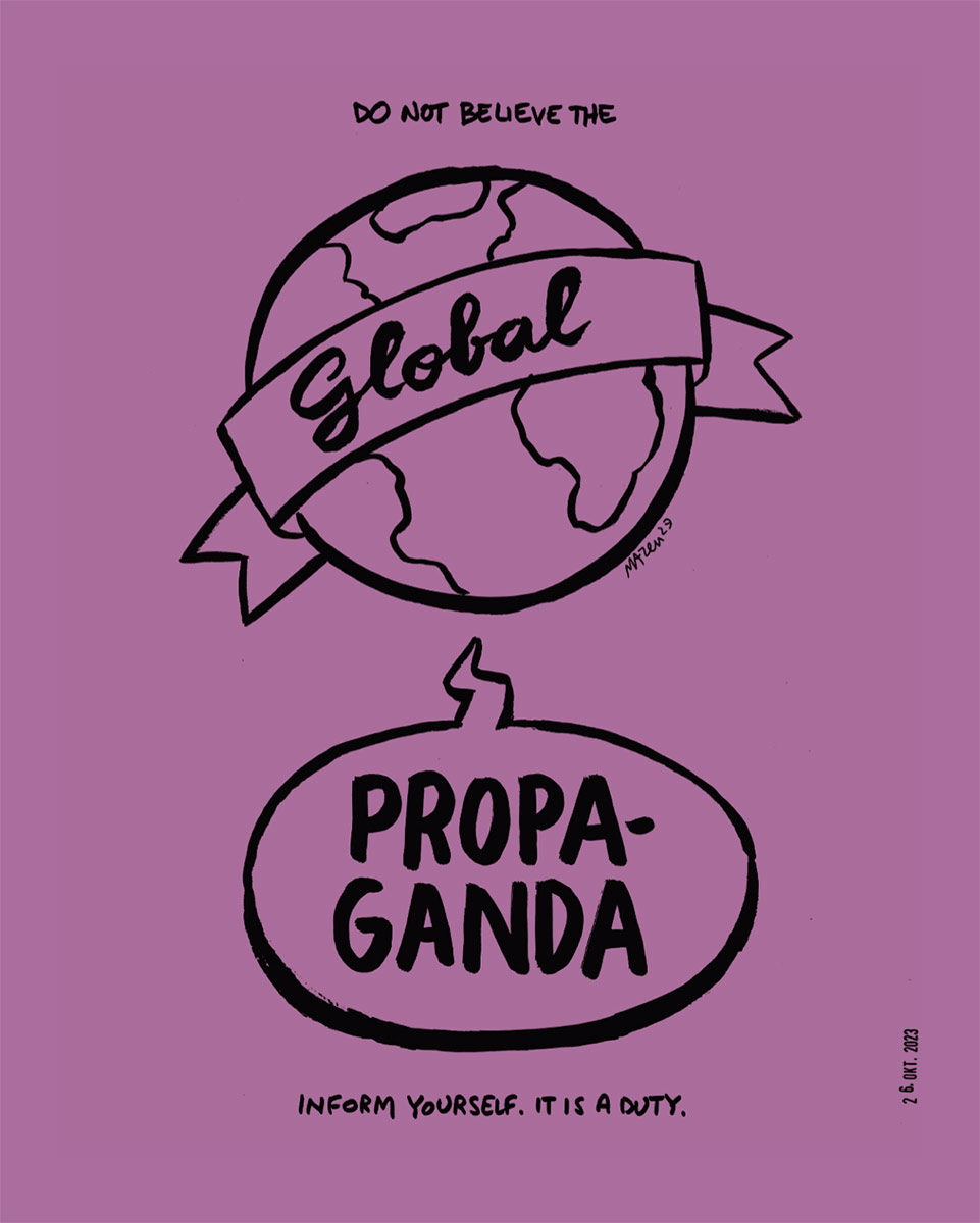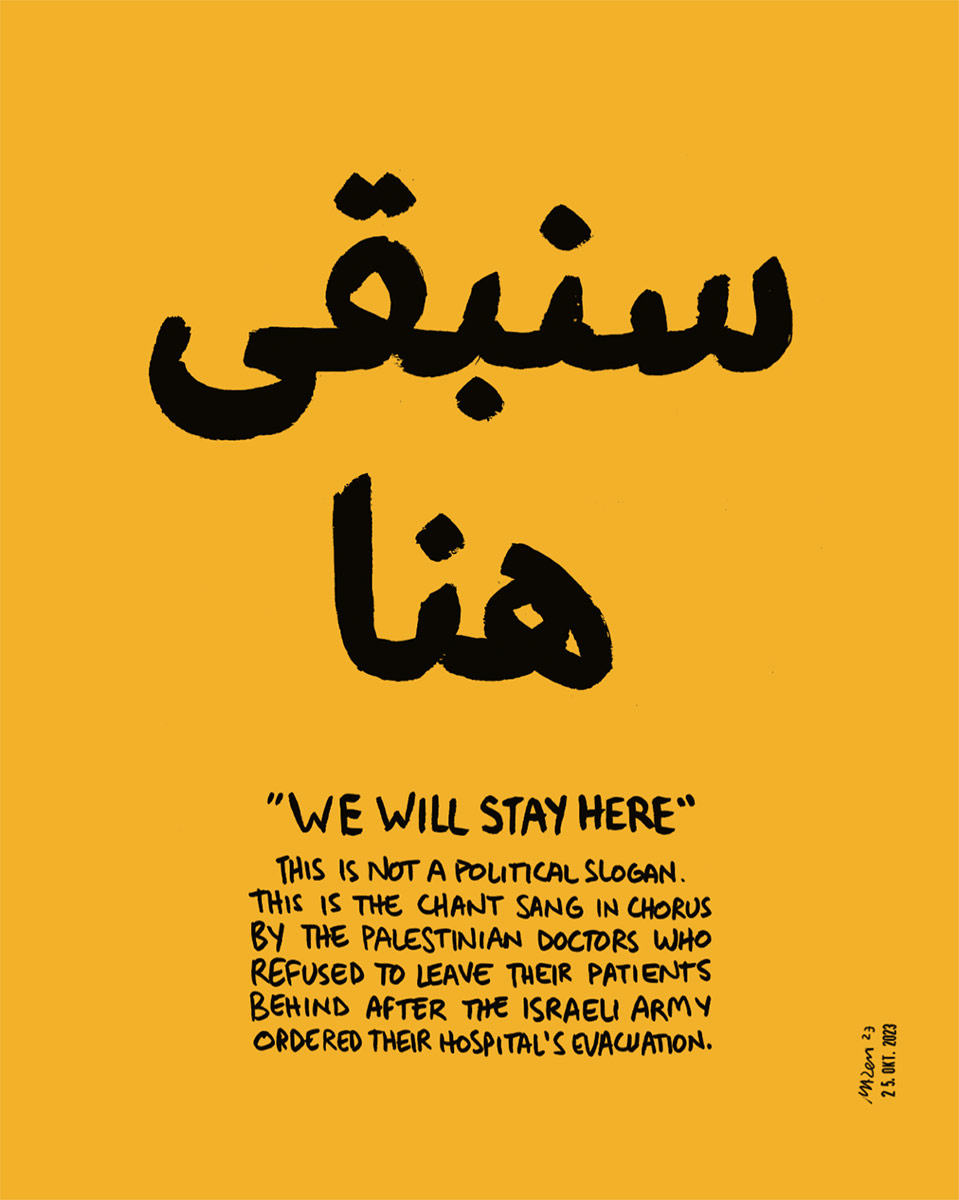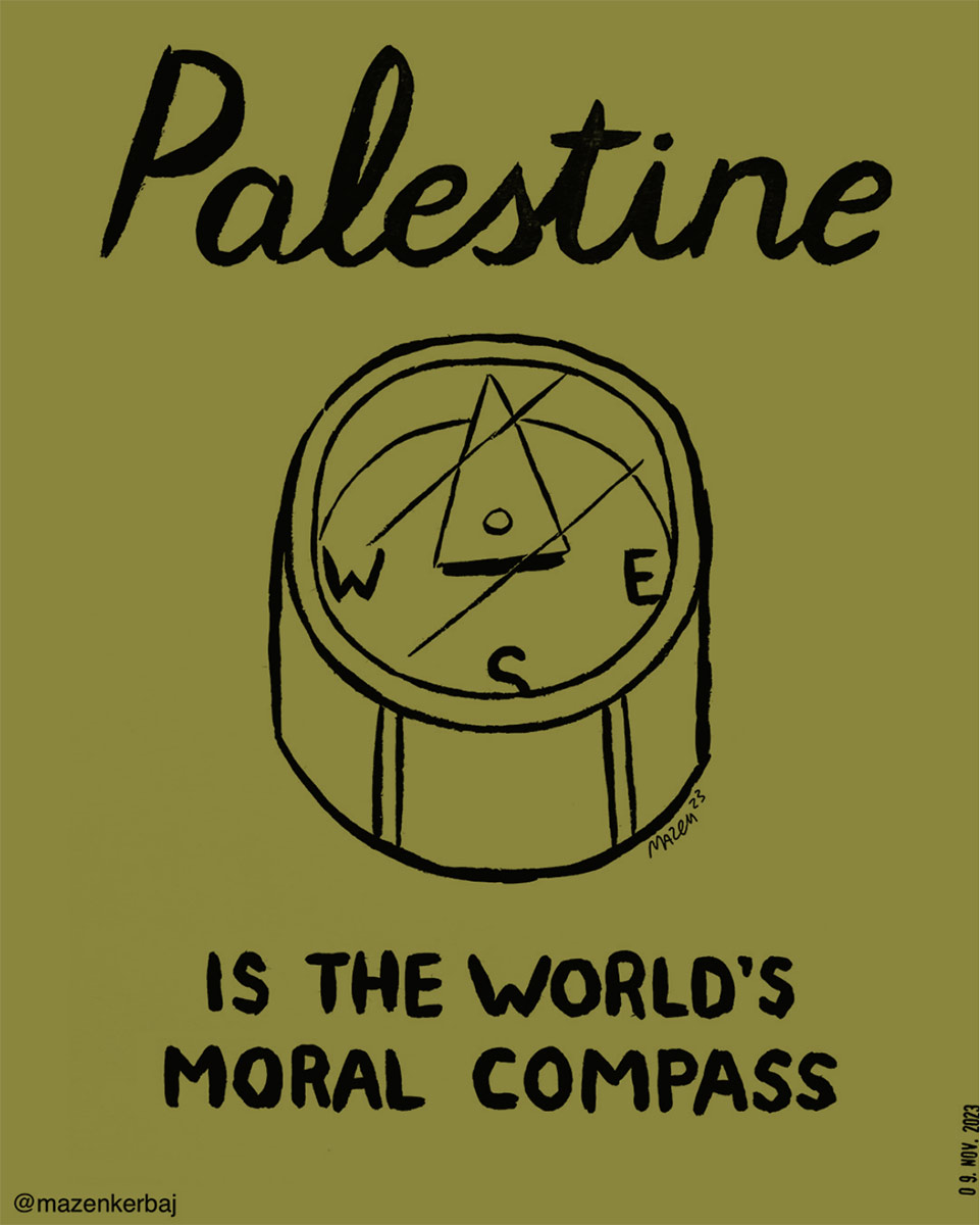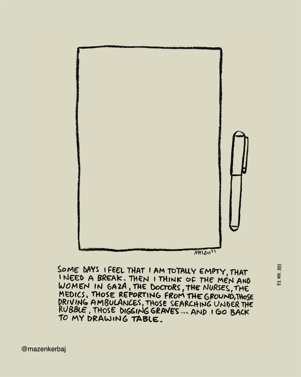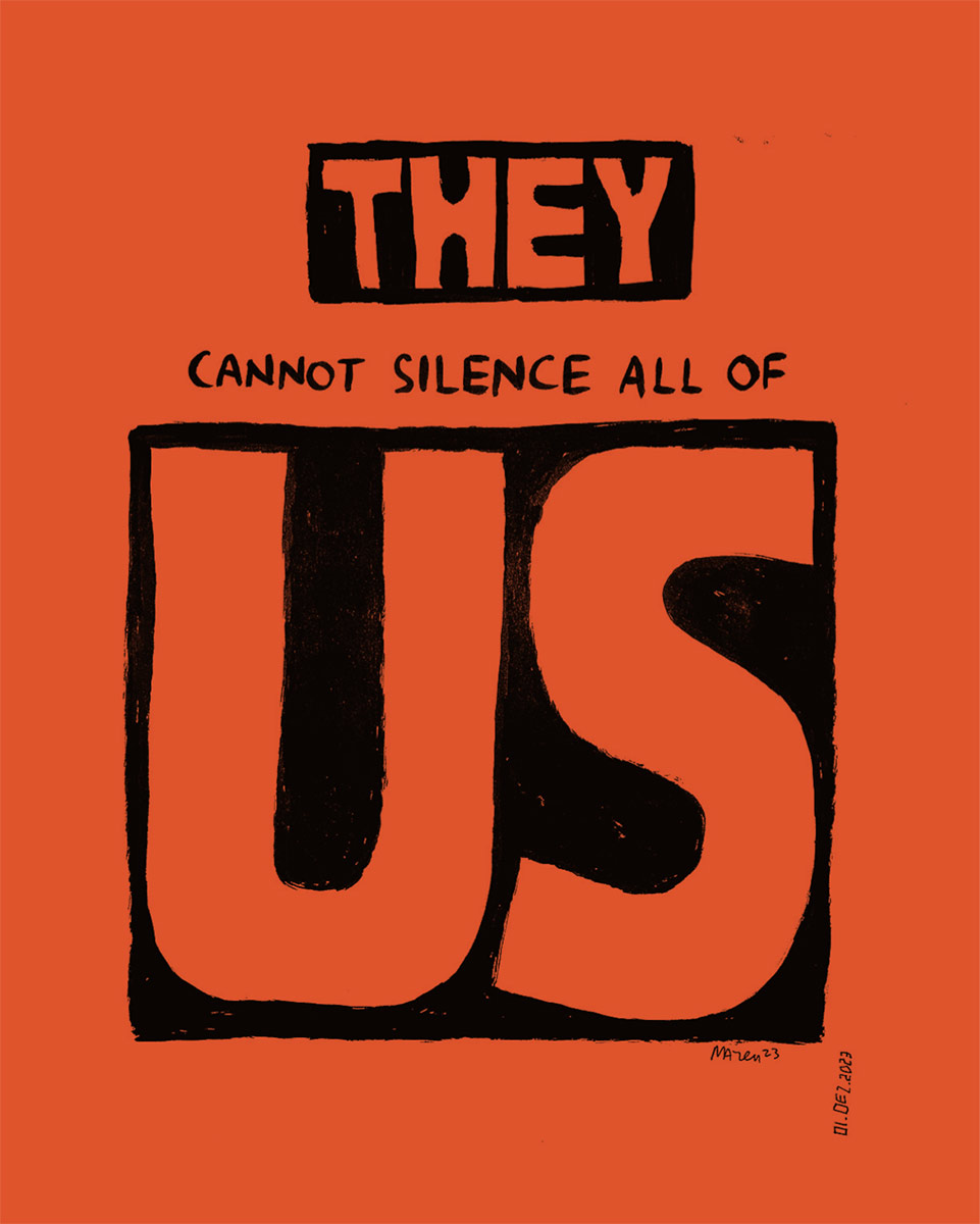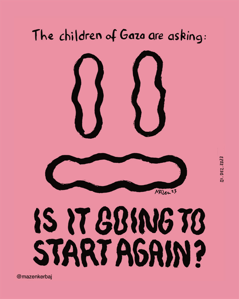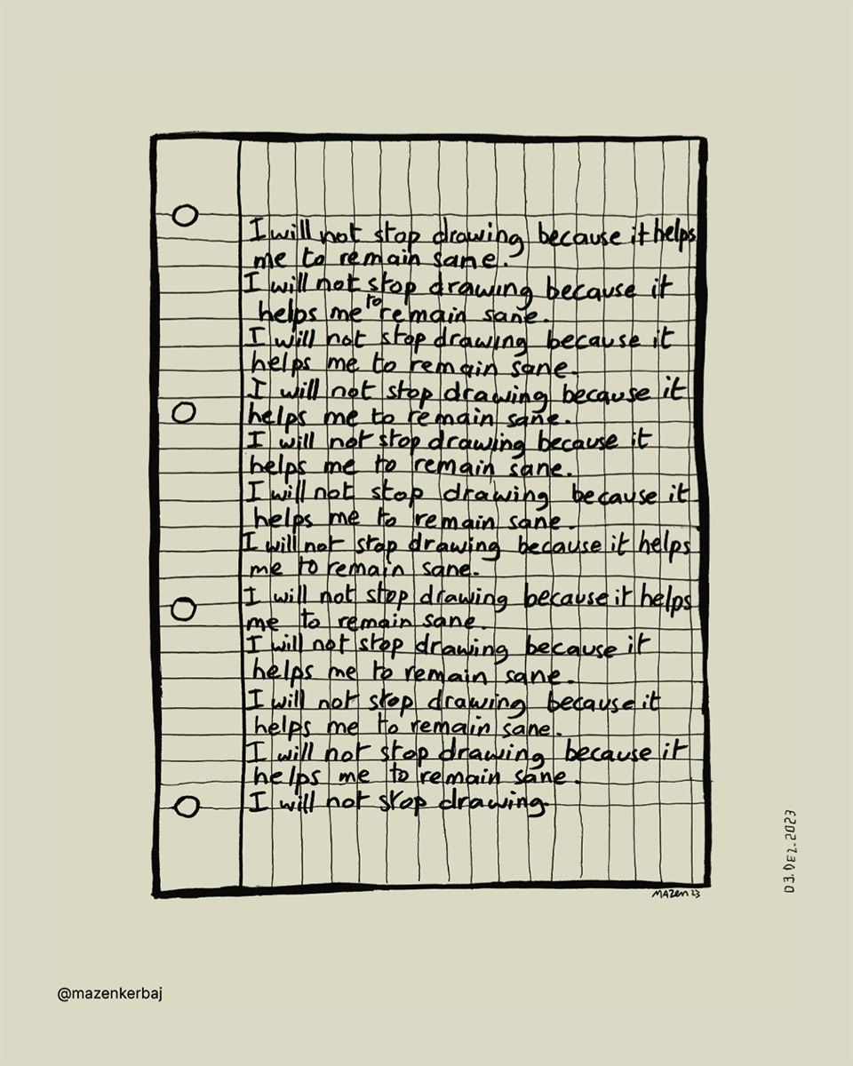

Mazen Kerbaj is a Lebanese illustrator, comics author, and visual artist known for his innovative approach to art. Born in Beirut in 1975, he has published over 15 books, with his works translated into many languages. Over the last year, his illustrations have so thoughtfully & devastatingly reflected the genocide happening in Palestine. This is our selection of his works to share with you all.